
 Slovenščina
 Bosanski
 Hrvatski
 Čeština
 Dansk
Dansk Dutch
Dutch Suomi
Suomi Français
 Deutsch
 Magyar
 Italiano
 Polski
 српски
 Slovenčina
 Español
 Svenska
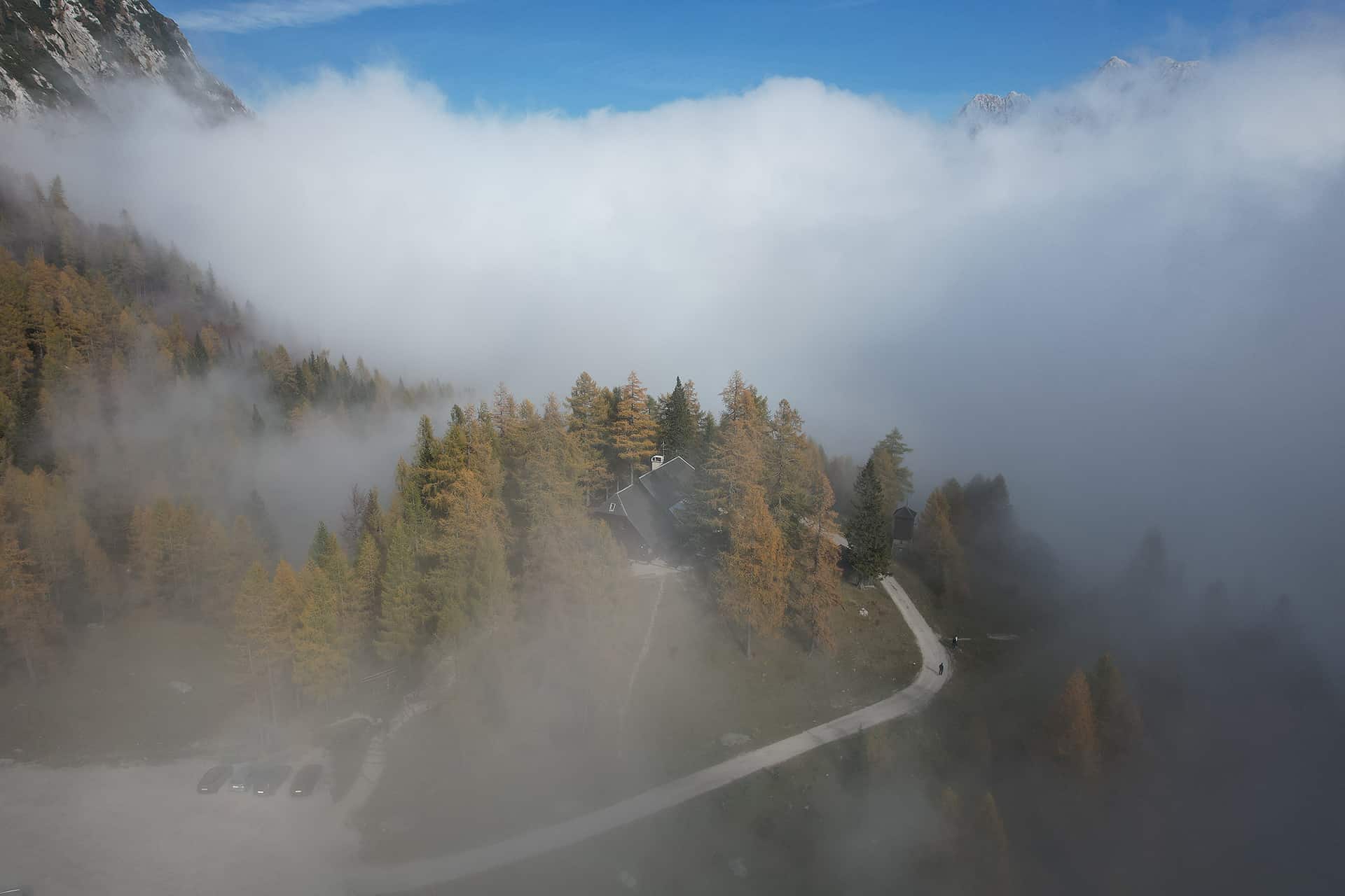
On this page
Jump to the most useful sections of this guide.
Quick summary
The most useful points from this guide before you continue.
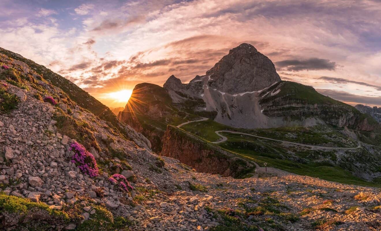
Stay on Vršič Pass
Stay at Erjavčeva koča on Vršič Pass
Erjavčeva koča is a mountain hut at Vršič Pass, between Kranjska Gora, Trenta, the Soča Valley and the Julian Alps. It is a practical base for hikers, road-trippers, cyclists and guests who want to stay close to the mountain pass.
- Direct location on the Vršič Pass road
- Good base for hiking, scenic drives and Julian Alps day trips
- Useful for guests visiting Kranjska Gora, Trenta, Soča Valley and Triglav National Park
- Food, mountain-hut atmosphere and practical local information in one place
This block is designed for independent guests and self-service booking. It does not imply a price guarantee or live availability.
Before you book your stay
Vršič Pass is a high mountain location, so it is worth checking a few practical details before you travel. This helps you plan your arrival, parking, hiking day and overnight stay more easily.
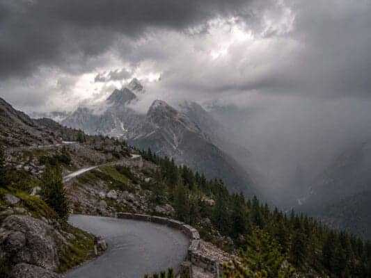
Access and road conditions
The Vršič road can be affected by season, weather and traffic. Before travelling, check current access information and plan enough time for the mountain road.
Parking
Parking rules and availability around Vršič can change by season and operator. Check the latest parking information before arrival, especially in busy periods.
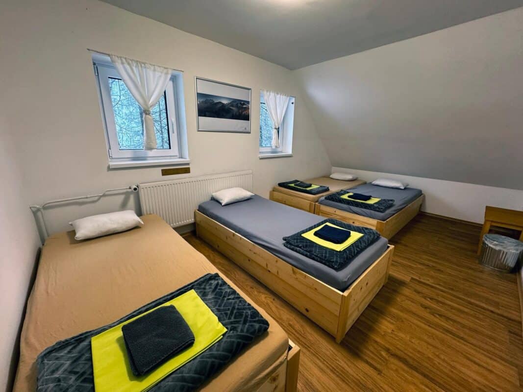
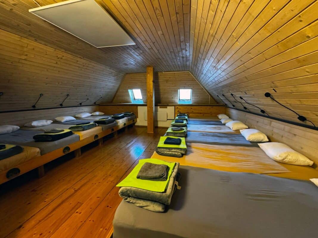
Rooms and overnight stay
If you plan to stay overnight, check room availability in advance. This is especially important during the hiking season, weekends and good-weather periods.
Food, opening hours and groups
Opening times may vary outside the main summer season or by arrangement with groups. Contact the hut directly for the latest information before making fixed plans.
Self-service planning for your stay at Vršič Pass
- Check room and availability options first.
- Read access, parking and arrival notes before travelling.
- Arrive with your own plan for Vršič, Kranjska Gora, Trenta and the Soča Valley.
- Use contact only for special cases, not for information already explained on the page.
A trusted mountain hut at Vršič Pass
Erjavčeva koča has been part of the Vršič mountain pass experience for generations. Guests use it as a practical alpine base for hiking, cycling, scenic drives, visits to Kranjska Gora and trips toward Trenta and the Soča Valley.
Ready to stay on Vršič Pass? Check the verified accommodation page and reserve directly with the hut.
Erjavčeva koča is a mountain hut at 1525 m, not a hotel or hostel. Come for nature, simple shelter and the rhythm of the mountains.
- ✓Unspoiled nature, mountain views and fresh alpine air
- ✓A place to rest before or after your mountain trip
- ✓Simple mountain-hut comfort and shared house rules
- ✓Direct access to Vršič, trails and Triglav National Park
- ×Hostel-style nightlife or loud late evenings
- ×Private bathrooms in every room
- ×Unlimited parking or guaranteed road access in every weather
- ×Perfect silence during busy mountain days
Before you book your stay at Vršič Pass
Use the booking information on this page to decide independently. Booking platforms can help with comparison, but your reservation should be clear before you travel. Contact is only for special cases.
Direct booking is best for
- Checking rooms and availability
- Reading access, parking and arrival details
- Booking when your dates and plan are clear
- Special questions only for groups, late arrival or winter conditions
Booking platforms are useful for
- Comparing accommodation options
- Reading platform-specific reviews
- Managing platform bookings in one account
- Using platform filters and policies
No price guarantee is implied. This block encourages self-service planning and reduces unnecessary calls or emails.
What happens after you check availability?
Checking availability is the first booking step, not a request for personal travel planning. Read the arrival, access and parking information before you book. Contact is only for special cases.
- Choose the room or stay option that fits your plan.
- Complete the booking request with your travel date and arrival plan.
- Before travelling, read the access, parking and seasonal notes; use contact only for groups, late arrival or winter conditions.
CTA clicks are measured as intent signals. This block is designed for self-service reservations and to reduce unnecessary calls or emails.
Summer visit: parking, hiking and rooms
In summer, Vrsic is busy with hikers, cyclists and scenic-road visitors. Plan arrival time, parking, weather protection and overnight questions before you leave.
- Arrive early when parking demand is high.
- Check weather before longer hikes.
- For overnight stays, contact the hut directly before travel.
This block is a practical planning reminder, not a live availability statement.
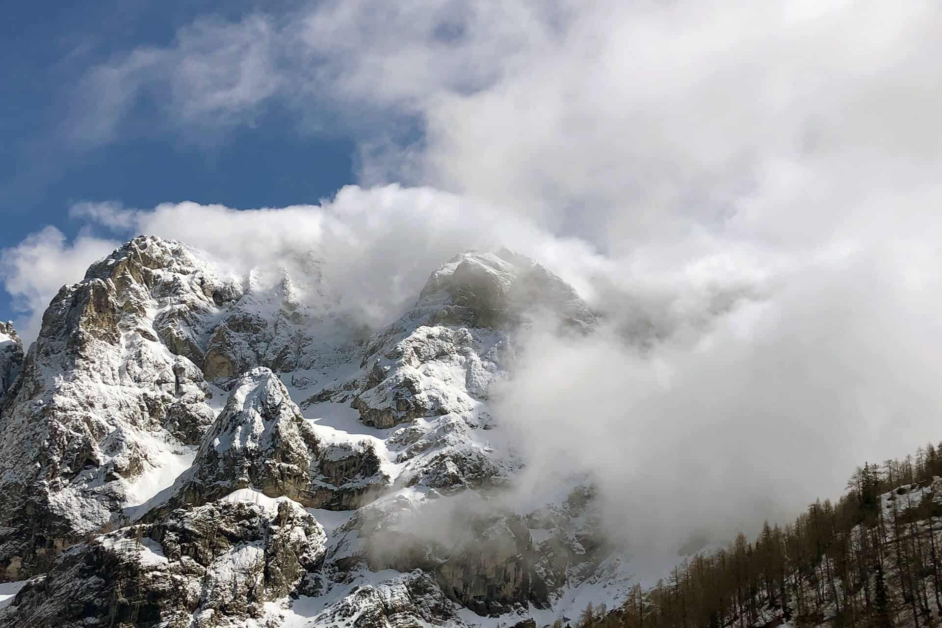
This guide is prepared from the perspective of Erjavčeva koča, a mountain hut on Vršič Pass. Use it together with current weather, road conditions and responsible behaviour in Triglav National Park.
Mangart Mountain and Mangrt Saddle
Mangart Mountain and Mangrt Saddle
Mangart Mountain and Mangrt Saddle
The area of mountain Mangart and the Mangartsko sedlo (Mangrt Saddle) is a popular destination of hikers and mountaineers, cyclists, botanical buffs and other admirers of the alpine world.
Although the easiest way to climb below Mangrt’s peak is along the Mangrt road, we recommend that you visit the area by public transport, by bike or on foot. Choose a section or hike the entire demanding climb from the valley to the peak. The trail offers many rewarding and unique panoramic views.
The Loška Koritnica Valley is a typical alpine valley, cut deep below the Mangrt and Jalovec mountains. The valley charms you with its steep walls and clear waters. Those of you who wish to observe the mighty Mangrt from afar can hike along an easy circular trail that is also suitable for families.
Mangart Mountain and Mangrt Saddle
What is less than 50 kilometers around the Erjavčeva mountain hut…
The road to Mangrt is open to traffic from the second half of June until the first autumn snowfall. During the no-snow season, the road is open until all the parking spaces near the Koča na Mangrtskem sedlu mountain hut are occupied. Due to traffic calming on the panoramic road, which also includes seasonal public hop-on/hop-off transfers, visitors can enjoy the panoramic views and alpine landscape of Mangrtsko sedlo away from the distracting noise of motor vehicles.
Mangart Mountain and Mangrt Saddle
MANGART OR MANGRT
The formal Slovene version is Mangart, but Slovenians also use the version Mangrt, since it is commonly used by the local people.
LOG POD MANGRTOM
The main settlement, Log pod Mangrtom, is comprised of Spodnji and Gorenji Log. The village boasts numerous natural and cultural sights. In the past, local people were mostly engaged in breeding small cattle and alpine pastoral farming, hunting, maintaining the road that runs over the Predel Pass and cart driving, while their survival was mostly ensured by working at the former lead and zinc mine in Cave del Predil, which was connected to Log pod Mangrtom via the so-called Štoln mining tunnel. This is the trailhead of the Walk of Peace.
STRMEC
This small village high above the valley lies right on the main road that was used in the past as the main traffic link between Gorizia and Villach. The village was most gravely affected by the Second World War, when German soldiers shot all the men and burned down the village. As a sign of mourning, the widows wore black headscarves and therefore the village was named “the village of black headscarves”. The site at St Michael’s Chapel is a magnificent vantage point for enjoying the sights of the valley and the surrounding mountains.
“SENARSKA” TRAIL
A well-arranged panoramic trail runs from Strmec to Gorenji stan or the Mangrtsko sedlo, its name originates from hay (“seno”). Since there was a lack of winter feedstuffs for sheep and goats, farmers used the “vrharjenje” method – mowing and harvesting grassland on pastures. Farmers carried hay in sheets and on their own backs from the Mangrt area to the villages in the valley.
VALLEY OF A HUNDRED WATERFALLS
During heavy rainfall, waters run to the valley in a hundred waterfalls and stop in forests, dark gorges and below the overhanging walls. They are clad in ice in winter, where even the shy sun cannot touch them. Regulated trails run to the waterfalls in Predelica, above the Fratarica Canyon and in the Nemčlja Gorge.
MANGRT ROAD
The road to Mangrt, the highest lying road in Slovenia, will take you up right below the Mangrtsko sedlo at an elevation of 2072 m. It is one of the most beautiful high mountain roads. Driving along the 12 km long road and through the five tunnels is an unforgettable experience, because it offers beautiful views of the Julian Alps. It was mostly built by hand by Italian soldiers in record time before the Second World War. Today, it presents quite a unique challenge for cyclists.
GEOLOGY AND THE STOVŽJE LANDSLIDE
The Mangrt Saddle and its surroundings make up one of the most beautiful and important geological heritage areas of the Julian Alps. Just like an open book, diverse rocks that emerged in various marine environments from the Upper Triassic, Jura and in Cretaceous sediments can be seen on the surface. When the Alps were forced upwards, the rocks that were spread over a large wide area were intensely pushed together, creased and thrusted, so that now they can be observed in a relatively small space; the results of strong pressure are visible in a multitude of creases, crevices and faults.
In the wider Mangrt area, special marlstone layers called the Raibl beds emerge. Combined with extreme precipitation in 2000, those beds had a tragic impact on triggering the Stovžje landslide that struck the valley of the Mangrtski potok stream. The landslide is considerd the largest natural disaster in Slovenia.
Mangart Mountain and Mangrt Saddle
FAUNA
Many preserved and protected animal species can be found below Mt Mangrt. The area is a habitat for chamois and alpine ibex, and you can observe marmots and rock ptarmigans or the golden eagle far in the sky. Mountaineers are accompanied by butterflies, western jackdaws, alpine salamanders, nose-horned vipers or common European adders. Western capercaillie and black grouse, roe deer and red deer live in the lower areas.
The rock ptarmigan belongs to the grouse family and lives above the tree line. In winter, its feathers turn white to keep it safe from predators. One of the most abundant populations in the Alps lives in the Mangrt area.
MAGNIFICENT WORLD OF PLANTS
The grassy plains under the peak of Mt Mangrt are most beautiful in early July, when they bloom in an amazing explosion of thousands of colours. Due to the diverse flora and floral specialities, these plains are quite well known far and wide. Here, we can find one of the rare or the only site of Alpine avens, marsh yellow cress, spike trisetum and common mugwort. The luxuriant alpine forest also stirs up great respect among admirers.
MANGRTSKA PLANINA PASTURE
Not far from the Stovžje landslide, sheep pasture is located along the Mangrtski potok stream. Shepherds with their herds of sheep have inhabited the Mangrtska planina pasture in summer months for more than five centuries. They still manage, graze and produce cheese in the traditional way, like their ancestors before them.
BOVEC SHEEP
This is an indigenous Slovene species that originates from the primary white sheep that was quite common in the alpine world in the past. It is the perfect breed for producing milk, which is traditionally processed into cheese, albumin cottage cheese and whey. The widely marketed “Bovški sir” brand with geographic origin is the foundation of local cuisine.
MANGRT AND ALPINISM
The first known climber to climb Mt Mangrt in 1794, was Franz Josef Hannibal Hohenwart, a Carniolan natural scientist. There are no written sources about the local shepherds and hunters who knew every inch of the mountain long before him.
The two most visited trails run to the top of Mangrt (2679 m) and both start at the Koča na Mangrtskem sedlu mountain hut. The right path, or the Slovenian direction, is very demanding marked trail, which can be walked in one hour and 45 minutes. The left or Italian path is a demanding marked trail, which you can walk in two hours.
Experienced climbers can choose the secured Italian path (via ferrata Italiana), where self-protection gear is mandatory. You can climb it in three hours.

Mangart Mountain and Mangrt Saddle
YOUR STEP MATTERS. IT DOESN’T TAKE MUCH, BUT MAKES A GREAT DIFFERENCE.
Harsh climate, young and shallow soil, and crumbly limestone rocks foster the growth of alpine flora. The sturdy vegetation along mountain and other trails is adapted to the demanding conditions of this highaltitude terrain. Attentive visitors who appreciate and respect the sensitive and fragile mountain environment observe the nature conservation, management, and aesthetic guidelines of mountain visitation and refrain from walking outside designated paths.

source: here
Trips and Hikes around the hut

Why visit a moutain hut?
We are open year-round
We are located in the heart of Triglav National Park
Book a stay in the iconic, first-built mountain hut on the Vršič Pass

Erjavčeva mountain hut is open year-round. Reserve your stay and spend some time in the natural paradise of Triglav National Park (UNESCO), near Kranjska Gora, on the Vršič mountain pass in the heart of the park.
Reserve your stayRelated mountain and travel guides
Choose the next verified guide for planning routes, parking, overnight stays and places near Vršič Pass.
- Is there anywhere I can park? — travel guide
- Snow on Vršič on May 12 – Why Mountain Weather Changes So Quickly — travel guide
- Stay longer in Slovenia — travel guide
- 10 Things to Do in Kranjska Gora and Around — travel guide
- Tamar valley — travel guide
- High mountain lakes — travel guide
Plan your visit from Erjavčeva koča
Useful guides, practical information and accommodation options for Vršič Pass, Triglav National Park and the Julian Alps.
Book your stay at Erjavčeva koča
Ready to stay on Vršič Pass? Check the verified accommodation page and reserve directly with the hut.
Road, parking and arrival FAQ
Use these answers before relying on a route, booking time or parking plan.
Is this a live Vršič road status?
No. The site can guide you to access information, but current road conditions should be checked before departure.
What should I plan before driving up?
Plan the approach, parking, arrival time and a backup option for mountain weather or seasonal traffic.
Can I use the hut as a base for nearby routes?
Yes, but match your route, daylight and return plan before you start.
Where should I go next on the site?
Use the verified access, parking or accommodation links shown on this page.