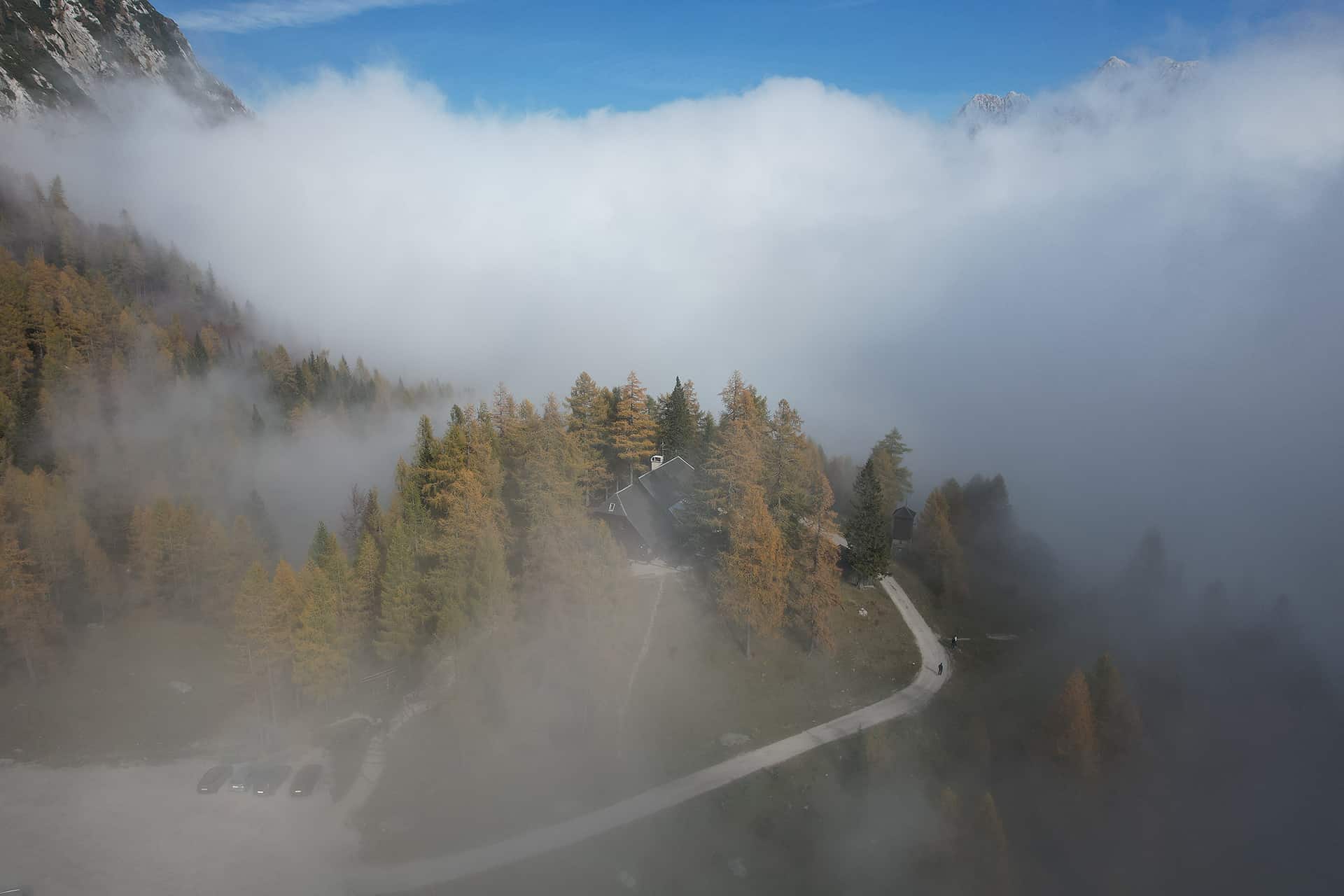
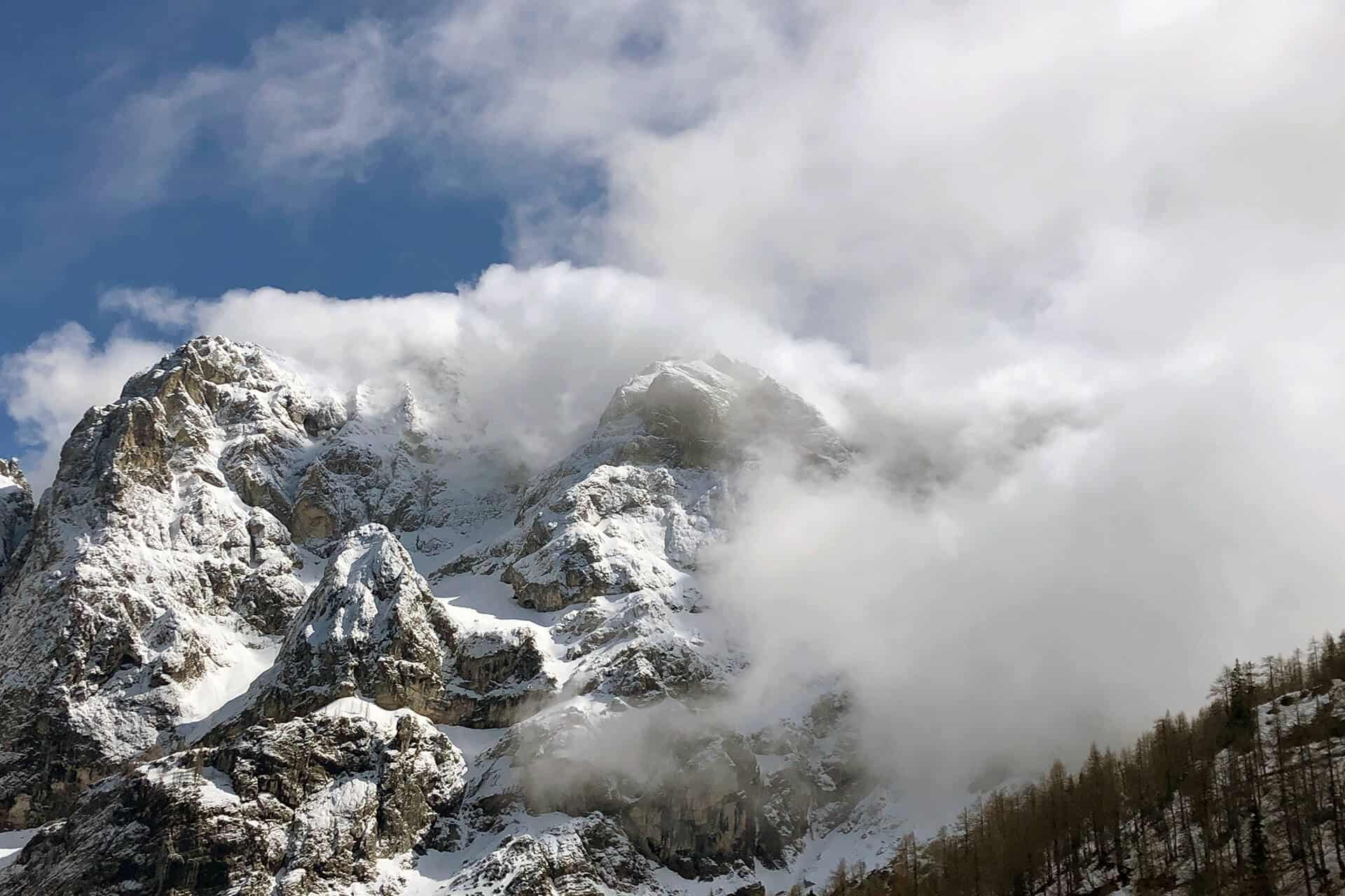
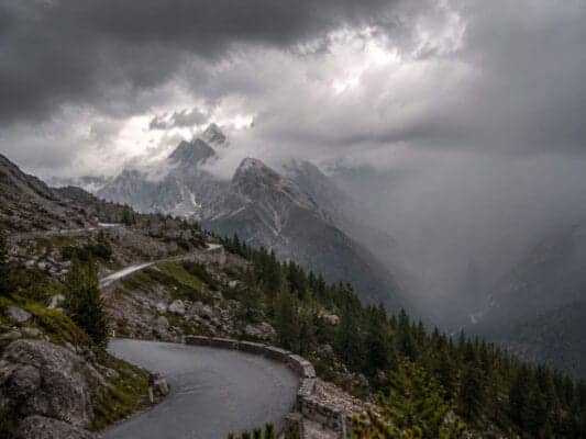
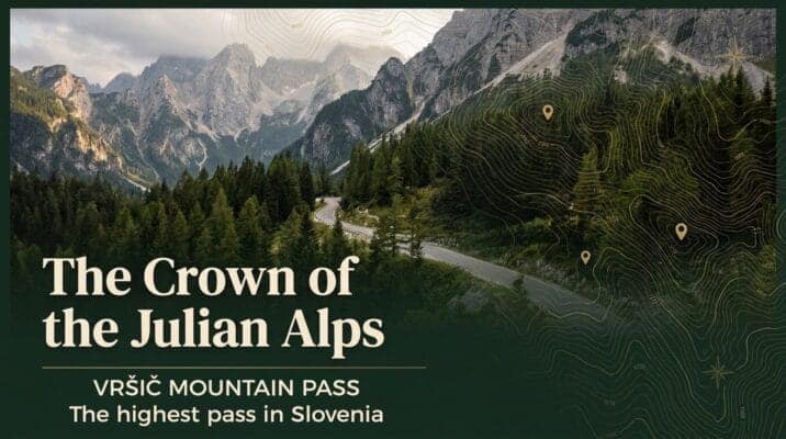
Erjavčeva koča is a mountain hut at Vršič Pass, between Kranjska Gora, Trenta, the Soča Valley and the Julian Alps. It is a practical base for hikers, road-trippers, cyclists and guests who want to stay close to the mountain pass.
Direct location on the Vršič Pass road
Good base for hiking, scenic drives and Julian Alps day trips
Useful for guests visiting Kranjska Gora, Trenta, Soča Valley and Triglav National Park
Food, mountain-hut atmosphere and practical local information in one place
This block is designed for independent guests and self-service booking. It does not imply a price guarantee or live availability.
Before you book your stay
Vršič Pass is a high mountain location, so it is worth checking a few practical details before you travel. This helps you plan your arrival, parking, hiking day and overnight stay more easily.
Access and road conditions
The Vršič road can be affected by season, weather and traffic. Before travelling, check current access information and plan enough time for the mountain road.
Parking
Parking rules and availability around Vršič can change by season and operator. Check the latest parking information before arrival, especially in busy periods.
Rooms and overnight stay
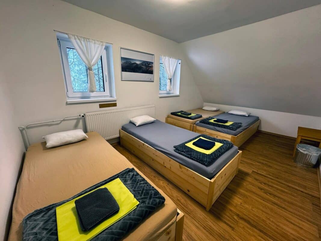
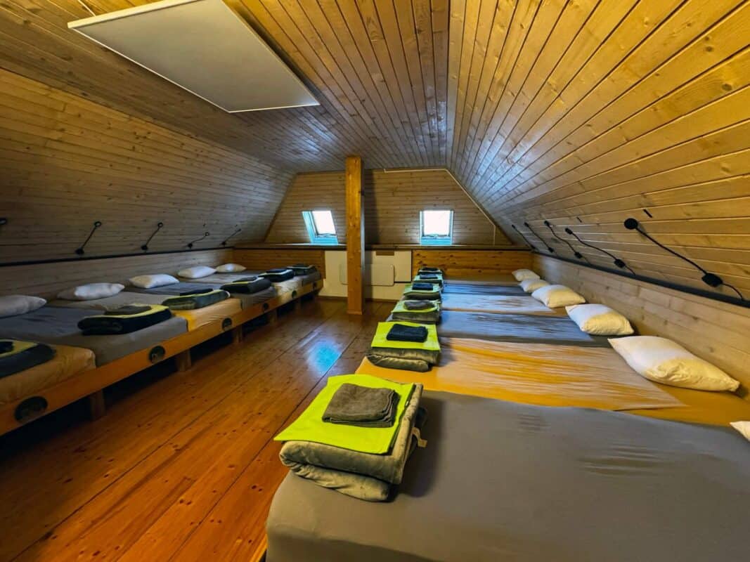
If you plan to stay overnight, check room availability in advance. This is especially important during the hiking season, weekends and good-weather periods.
Food, opening hours and groups
Opening times may vary outside the main summer season or by arrangement with groups. Contact the hut directly for the latest information before making fixed plans.
Self-service planning for your stay at Vršič Pass
Check room and availability options first.
Read access, parking and arrival notes before travelling.
Arrive with your own plan for Vršič, Kranjska Gora, Trenta and the Soča Valley.
Use contact only for special cases, not for information already explained on the page.
A trusted mountain hut at Vršič Pass
Erjavčeva koča has been part of the Vršič mountain pass experience for generations. Guests use it as a practical alpine base for hiking, cycling, scenic drives, visits to Kranjska Gora and trips toward Trenta and the Soča Valley.
Erjavčeva koča is a mountain hut at 1525 m, not a hotel or hostel. Come for nature, simple shelter and the rhythm of the mountains.
✓Expect
✓Direct access to Vršič, trails and Triglav National Park
✓Quiet evenings, early starts and weather-dependent mountain life
✓Food, shelter and practical help from the hut team
✓Unspoiled nature, mountain views and fresh alpine air
×Do not expect
×Perfect silence during busy mountain days
×A valley resort experience
×Luxury hotel rooms or city-hotel services
×Hostel-style nightlife or loud late evenings
Before you book your stay at Vršič Pass
Use the booking information on this page to decide independently. Booking platforms can help with comparison, but your reservation should be clear before you travel. Contact is only for special cases.
Direct booking is best for
Checking rooms and availability
Reading access, parking and arrival details
Booking when your dates and plan are clear
Special questions only for groups, late arrival or winter conditions
No price guarantee is implied. This block encourages self-service planning and reduces unnecessary calls or emails.
What happens after you check availability?
Checking availability is the first booking step, not a request for personal travel planning. Read the arrival, access and parking information before you book. Contact is only for special cases.
Choose the room or stay option that fits your plan.
Complete the booking request with your travel date and arrival plan.
Before travelling, read the access, parking and seasonal notes; use contact only for groups, late arrival or winter conditions.
CTA clicks are measured as intent signals. This block is designed for self-service reservations and to reduce unnecessary calls or emails.
Summer visit: parking, hiking and rooms
In summer, Vrsic is busy with hikers, cyclists and scenic-road visitors. Plan arrival time, parking, weather protection and overnight questions before you leave.
Arrive early when parking demand is high.
Check weather before longer hikes.
For overnight stays, contact the hut directly before travel.
This block is a practical planning reminder, not a live availability statement.
This guide is prepared from the perspective of Erjavčeva koča, a mountain hut on Vršič Pass. Use it together with current weather, road conditions and responsible behaviour in Triglav National Park.
Last updated: 18/04/2026Reading time: 9 min readPrepared by: Erjavčeva koča team
The Earthquake of All Earthquakes and Other Secrets Hidden at the Bottom of Lake Bohinj
The Earthquake of All Earthquakes and Other Secrets Hidden at the Bottom of Lake Bohinj
12,000 Years of Turbulent Geological History in the Julian Alps
6,600 years ago, our region was shaken by an earthquake that far exceeded in strength any recorded in history. It was much stronger than the well-known Ljubljana earthquake 131 years ago, and even more powerful than the infamous Idrija earthquake of 1511.
Slovenia is an extremely seismically active area, so it is no surprise that very strong earthquakes also occurred in our region in the distant past. What is not so simple, however, is discovering their traces. In fact, the conditions have to be just right.
The Earthquake of All Earthquakes and Other Secrets Hidden at the Bottom of Lake Bohinj
The researchers, of course, did not know they would discover the strongest earthquake ever identified in our region when they set out to investigate the sediments beneath the bottom of Lake Bohinj. Lake sediments are an extremely valuable source of information on a wide range of topics. Deep beneath the floor of the lake’s deepest part, traces from distant periods are well preserved, protected from change and drying. Former floods and earthquakes, as well as changes in vegetation and climate around the lake, are all beautifully recorded in lake sediments.
An Archive of the Past Hidden in Lake Sediments
To access this hidden information, geologists drilled a core into the bottom of Lake Bohinj. This was by no means a simple task. The ideal location for obtaining the best historical data is the bottom of the deepest part of the lake, where sediments are least disturbed; only the most powerful events can disturb them. In the case of Lake Bohinj, this meant drilling 45 meters below the lake’s surface. To have any chance of success, the scientists also needed a long stretch of favourable weather.
After some difficulties with storms and equipment, they drilled a 12-meter-deep core and ultimately succeeded in extracting the same length of lake sediments. As later dating showed, these sediments span the entire Holocene period, from the end of the last Ice Age about 11,700 years ago, or, in more scientifically precise terms, to the beginning of the present interglacial period in which we are still living. In other words, we obtained an archive covering the entire period from the formation of Lake Bohinj during glacier retreat to the present day. And in it, various surprises awaited discovery, including the strongest earthquake yet identified in our region.
The Earthquake of All Earthquakes and Other Secrets Hidden at the Bottom of Lake Bohinj Foto: / Maja Andrič / Marko Zaplatil / Nina Caf
The Earthquake of All Earthquakes
It is not possible to determine this earthquake’s exact magnitude with certainty. Its force can, however, be inferred indirectly.
“This earthquake was really something special. Other earthquakes, such as the Idrija earthquake and the great Carinthian earthquake, which were both very strong, left layers a few tens of centimetres thick at the bottom of the lake. But this one left a layer more than four meters thick. So you can imagine that this was a much bigger event and a much stronger earthquake,” explains geologist Andrej Šmuc from the Faculty of Natural Sciences and Engineering at the University of Ljubljana.
Naturally, the question arises: where did all that material come from? From the edges of the lake, Šmuc answers. Lake Bohinj is roughly bowl-shaped. Around the edges, it is relatively shallow, then it deepens to 45 meters. Material brought in by the Savica River is deposited along the margins; wind-driven waves move it around somewhat; and only a larger event, such as an earthquake, flood, or heavy rainfall, triggers a kind of underwater landslide that sends this material to the deepest part of the lake.
Fortunately, the bottom of Lake Bohinj is shaped in such a way that it is possible to clearly distinguish sediments deposited by floods from those deposited by earthquakes. In the sediments at the bottom of the lake, the great earthquake from 6,600 years ago was followed by the traces of 29 smaller earthquakes.
That the earthquake, which deposited a four-meter layer of sediment on the lake bottom, was truly extraordinary is also most likely confirmed by traces from the Soča Valley. At roughly the same time and therefore probably during the same earthquake, half a mountain collapsed into the glacial lake that once existed around present-day Bovec, creating what is known as the Bovec terrace, Šmuc further explains.
The Bohinj sediments also show that over these 12 millennia, the Mostnica stream periodically, at times for 50 or 200 years, flowed directly into the lake, whereas today it naturally flows past the lake and empties directly into the Sava Bohinjka.
The Earthquake of All Earthquakes and Other Secrets Hidden at the Bottom of Lake Bohinj Foto: / Maja Andrič / Marko Zaplatil / Nina Caf
The History of Climate and Environmental Change
As mentioned, the core sediments reveal not only dramatic geological events, such as earthquakes, but also gradual changes in vegetation around the lake. Fossil pollen and other organic remains can tell us a great deal about what was growing around the lake in a given period and how that vegetation changed over time.
Moreover, Lake Bohinj is not the only lake whose bottom researchers explored for traces of the past. Cores were also drilled into the lake at Planina pri Jezeru and into the lake at Ledvice in the Triglav Lakes Valley.
The core from the lake at Planina pri Jezeru takes us 13,000 years into the past, explains palynologist Nina Caf from the Institute of Archaeology at ZRC SAZU. At that time, the whole area was very marshy, so we cannot even say with certainty whether the lake itself already existed. But the pollen remains clearly show the transition from the Pleistocene to the Holocene, when pine and birch began to be replaced by spruce and oak. Around 10,000 years ago, beech appeared, and 8,200 years ago, fir as well. The lake at Ledvice revealed that the tree line was once higher than it is today, as forests once covered the area around the lake.
The First Traces of Humans and Grazing Domestic Animals
At the time of the earthquake 6,600 years ago, mixed forests of spruce, beech, and fir thrived around Lake Bohinj, much as they do today, except that there was considerably more fir, explained palynologist Maja Andrič. At that time, however, the first grazing indicators also appeared at higher elevations—signs that domestic animals were already being grazed there. Researchers detected that the proportion of trees in the area had decreased, while traces of plants such as narrowleaf plantain, which thrives even when trampled by animals, and herbivore dung spores appeared.
So did people feel the great Bohinj earthquake back then? Most likely, says archaeologist Jana Horvat, a longtime associate of the Institute of Archaeology at ZRC SAZU. But the Julian Alps, where the earthquake’s epicentre most likely lay, were very sparsely populated in those times. In the Julian Alps, traces of humans appear at the end of the 4th millennium BC and in the early 3rd millennium BC, that is, at the end of the Copper Age and the transition to the Bronze Age. This was also the period when the pile dwellings of the Ljubljana Marshes were inhabited. Then, for about a thousand years, traces of humans in our region almost completely disappeared, and signs of settlement reappeared only in the middle of the 2nd millennium BC, when Bled was inhabited, but not Bohinj.
Pollen of black pine (Pinus nigra), light microscope, 400x magnification. Photo: Personal archive / Marko Zaplatil
Strong Erosion in the Iron Age
Human presence in the Alps increased significantly in the Iron Age. Around 600 BC, large areas of forest around Lake Bohinj must clearly have been cut down, explains Maja Andrič, because the sediments revealed traces of strong erosion, the likes of which had been seen neither before nor after.
The Bohinj area was rich in iron ore; the ore lay on the surface and could be collected easily, explains archaeologist Jana Horvat. The ironworkers of the time needed large quantities of charcoal for the first stage of ore processing, which most likely explains the great demand for wood that triggered extensive deforestation and the major erosion mentioned above.
We also know that the first people to settle around Lake Bohinj came from the Soča Valley, from settlements around Most na Soči, Horvat explains. Until the 16th century, the Sava gorge was impassable, and access to the shores of Lake Bohinj from the Gorenjska side was possible only via Pokljuka. It is therefore not surprising that characteristic archaeological remains indicate that the culture inhabiting the area around Lake Bled at the time differed significantly from that found around Lake Bohinj.
Imported Soil
Lake sediments not only testify to the washing of large quantities of soil into the lake during certain periods, but also reveal another puzzle connected with soil in the Alps.
Here, the Alps are beautiful in white and grey shades thanks to the limestone and dolomite of which they are composed, explains geologist Andrej Šmuc. But these are carbonate rocks, which rainwater dissolves very effectively. That is why our high mountains feature many interesting karst phenomena, but they also provide a very poor basis for fertile soil formation.
“For good soil, we need clay minerals, the kind found on igneous and metamorphic bedrock, not on carbonates. On carbonates, the soil consists only of the remains of plant material, of those few trees that fall and rot. But we do know that we have soils that are not as worthless as one would expect on extremely pure limestone and dolomite,” says Šmuc.
So the question arises: where does the material that forms soil in the Alps come from? Scientists found a surprising answer in the core drilled from the lake at Ledvice.
source: here
Foto: / Maja Andrič / Marko Zaplatil / Nina Caf
We are located in the heart of Triglav National Park
Book a stay in the iconic, first-built mountain hut on the Vršič Pass
Erjavčeva mountain hut is open year-round. Reserve your stay and spend some time in the natural paradise of Triglav National Park (UNESCO), near Kranjska Gora, on the Vršič mountain pass in the heart of the park.
We use cookies to improve your browsing experience, measure traffic, and enhance website functionality. You can accept all cookies, reject non-essential cookies, or manage your preferences. Cookie Policy,
Privacy Policy
and Terms of Use.
!
Google Maps displays incorrect information that the road to Erjavčeva koča is closed. The road to Erjavčeva koča is open and normally passable from both directions.



 Slovenščina
 Bosanski
 Hrvatski
 Čeština
 Dansk
Dansk Dutch
Dutch Suomi
Suomi Français
 Deutsch
 Magyar
 Italiano
 Polski
 српски
 Slovenčina
 Español
 Svenska